
Horton Plains is one of the most visited places in Sri Lanka, loved by both local and foreign travellers. Among all the attractions in Horton Plains, World's End is a place that almost every visitor makes sure to see. From the main entrance of Horton Plains, a walk of about 5 kilometres will take you to this breathtaking viewpoint.
While standing at World's End and enjoying its beauty, one might wonder what it would be like to travel from the valley below all the way up to the top. Today, we are ready to do exactly that. Our journey takes us through the Nanperial Estate, the beautiful tea estate that can be seen far below when looking down from World's End, and continues towards the boundary of Horton Plains.
Most people who visit World's End use the road through Nuwara Eliya and Pattipola. Those coming from Haputale or Welimada can also use the road through Ohiya. If someone has a capable 4WD vehicle and wants a more adventurous experience, it is also possible to travel from Kalupahana, passing Bambarakanda Falls and Udaveriya, towards Ohiya. However, among all these routes, the road that runs through Nanperial Estate from the lower side of World's End towards Horton Plains is perhaps the most beautiful in terms of natural scenery.
When we look down from the World's End viewpoint, we can see the Hirikatu Oya valley, the Nanperial Estate, and the line rooms of the estate workers who live there. The road leading into this estate begins on the Balangoda-Haputale road, about 2 kilometres after passing Belihuloya. Since there is a signboard for Nanperial Estate, finding the entrance is not very difficult.
From the main road, vehicles can travel about 23 kilometres along this scenic route. We started our journey early in the morning because mist usually begins to cover the upper areas of Nanperial after around 10.00 a.m. Once the mist comes in, it becomes difficult to see the beautiful views along the way. Therefore, for any traveller hoping to enjoy this route properly, starting early is very important.
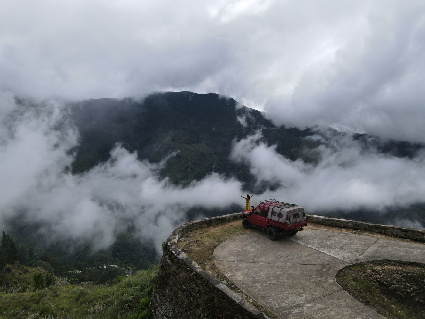
As we travelled for several kilometres along the Hirikatu Oya valley, we saw several small waterfalls. Our team stopped for a while at a beautiful bend in the road to enjoy the surrounding views. During that short break, we flew our drone camera to see the beauty of the mountain range from above.
Because of the rain during these days, Adara Kanda, which could be seen ahead of us, looked especially beautiful. The rain had also blessed the Nanperial mountain slopes with many waterfalls. As we continued along the winding road, we came across Nanperial Ella, a waterfall that drops in three levels right beside the road. This waterfall added a special charm to our journey.
After saying goodbye to the waterfall, we continued along the winding mountain road. The road is narrow, and the way it has been built with sharp bends along the mountain slope is truly remarkable. After travelling about 12 kilometres, we reached the area near the Nanperial Tea Factory. From this point upwards, permission from the estate management is required. Since we had arranged this earlier, we did not face any difficulty.
The road above the Nanperial Factory is extremely narrow. Because of this, drivers must be very careful. A small mistake could be dangerous, as there are steep drops of hundreds of feet beside the road. As we reached the area where Baker's Bend became visible, we saw a group of people concreting a section of the road. Later, we learned that this was a place that had suffered a landslide during the recent rains.
Baker's Bend is one of the most beautiful places along the Nanperial road. It has been built at a very difficult point where the road had to be taken higher up the mountain through a sharp bend. Tea cultivation in the Nanperial Estate began in 1920. A British estate superintendent named V. E. Baker played a major role in developing the road system of this estate. In memory of him, this famous bend was named Baker's Bend.
Located more than 5,000 feet above sea level, Baker's Bend offers a stunning view of the valley below and a large part of southern Sri Lanka. We made sure to spend some time there and enjoy the surrounding beauty. From Baker's Bend, the Gommolliya and Balathuduwa mountain ranges stand proudly ahead. During our visit, many waterfalls were flowing down from these mountains, creating a truly unforgettable sight.
A cloud of mist that came from the direction of Samanalawewa suddenly covered the whole of Baker's Bend within a few moments. Then, just as quickly, the clouds cleared away again. This is one of the special features of this place. Usually, mist begins to arrive here after around 10.00 a.m., so it is always better to visit early in the morning.
To the right side of Baker's Bend lies the Gonmale mountain range. On one part of this mountain, there is a naturally formed shape that resembles the map of Sri Lanka. If you visit this place one day, look carefully and you may be able to see this unique natural formation.
By this time, we had travelled about 20 kilometres up the Nanperial Estate road. Baker's Bend is the 23rd bend on this route, and it was the most beautiful bend we had seen during the journey. After spending some time there, we started our journey again.
From Baker's Bend, we still had to climb about another 2,000 feet in elevation. To gain that height, we had to travel roughly another 3 kilometres. This section of the road is more difficult than the lower part, so we had to travel very slowly.
After about two more kilometres, we reached the Nagrak Division. The elevation here is recorded as 6,990 feet above sea level. This area feels like a natural wind gap. On one side lies the Belihuloya direction, and on the other side lies the Bagawanthalawa direction. By this point, we had reached very close to Horton Plains.
There was still about another kilometre to travel before reaching the end of the road. The Nanperial road finally ends at the boundary of Horton Plains. After this point, we passed the line rooms of the Tamil estate workers who live in the Nagrak Division. The small children there, probably surprised to see an outside vehicle in such a remote area, looked at our vehicle with wide eyes and curiosity.
Compared with the lower part of the estate, the tea cultivation in this upper area appeared more fertile. The Nagrak section is much cooler than the dry lower areas, most likely because it is located right on the boundary of Horton Plains.
We had to reverse and turn the vehicle one final time at the 33rd bend. By then, we had completed 23 kilometres and passed 33 bends. I think this may be one of the roads in Sri Lanka with the highest number of bends over such a distance.
Now we were travelling along the top of the mountain. After another 500 metres, we reached one of the most beautiful places in the Nagrak section: the Nagrak Estate Bungalow. Spending a night at this bungalow is a dream for many travellers. At the time of our visit, it was closed for renovation. According to the estate superintendent, Mr. Dennis, the renovation work had been completed, but the bungalow had not yet been reopened. He mentioned that it would be opened to visitors in the coming February.
The bungalow was built around 1938 by Mr. V. E. Baker. When he was travelling through this area towards Ohiya, he noticed the beauty of this location. After that, the estate bungalow was built here. From this place, a vast area of southern Sri Lanka can be seen. On a clear day, it is even possible to see as far as the Hambantota coast.
Behind the estate bungalow lies Horton Plains. There is also a footpath from this area towards World's End, but permission is not granted to use it. In the past, tea produced in this estate was taken to Ohiya along a road built through Horton Plains. Even today, traces of that old route can still be seen, although it is now covered by forest. The footpath leading towards World's End also follows that old, overgrown route.
In earlier days, tea chests produced at the Nanperial Factory were brought up to the bungalow area using a cable system that ran from the lower section of the estate. Some parts of that old cable system can still be seen near the estate bungalow today.
Nanperial Estate is located on the western slope of Sri Lanka's central hills, and the rainfall pattern here is quite different. The location of the estate seems to have a strong influence on this. Anyone travelling from the lower part of the estate to the upper section can clearly notice this difference. Although the environment is beautiful, the lower part of the estate has a rather dry and rough nature, and the tea cultivation there does not appear very fertile. However, the upper parts are cooler and greener.
At a time when some plantations are abandoned when they become unprofitable, it is worth appreciating the effort taken to continue maintaining Nanperial Estate despite its difficulties. This helps protect the jobs of the estate workers who live there. For this, appreciation should be given to Mr. Harry Jayawardena, Chairman of the Balangoda Plantations Company, for continuing to maintain the estate as a form of welfare service as well.
It is also commendable that the old estate bungalows, some of which are nearly a century old, are still being protected and preserved for future generations to see.
With the hope of meeting again from another beautiful place in Sri Lanka, we say goodbye for today. The video footage of this journey can now be watched on our Travel Weekend YouTube channel.
Finally, we would like to express our special thanks to Mr. Kasun Pallamulla, Senior Assistant Superintendent of Spring Valley Estate, and Mr. Dennis Sri Chandrasekara, Superintendent of Nanperial Estate. Without their support, this journey would not have been possible.