
Sri Lanka is a country blessed with remarkable geographical diversity and rich biodiversity. When we look at the physical landscape of our island, it can clearly be divided into three main regions: the coastal plain, the interior plains, and the central highlands.
Anyone who observes the central highlands carefully can clearly see the points where the mountains separate from the interior plains. One such area is the mountain range that stretches from Haputale to Madulsima. From the lower plains, this range rises suddenly like a great wall, creating a dramatic gap in the landscape.
Along this scenic gap, we can identify several beautiful viewpoints and locations, including Lipton's Seat, Pilkington Point in Poonagala, Ella Gap, Mini World's End in Madulsima, and Babara Gala Pathana. Today, we are getting ready to take you to Babara Gala Pathana, one of the most beautiful yet lesser-known places in Sri Lanka.
We began our journey from Kurunegala, travelled to Kandy, and from there continued along the Raja Mawatha through Kandaketiya to reach Badulla. From Badulla, we went to the upper section of Spring Valley Estate, where we spent the night at the estate bungalow known as Punchi Mahattaya's Bungalow. Our plan was to leave early the next morning for Babara Gala Pathana.
The Maha rainy season had already begun during these days. Fortunately, the rain did not disturb us during the two days we travelled. Both days were bright and clear. After spending the night at the estate bungalow, we woke up early in the morning, hoping to reach Babara Gala Pathana before the mist covered the views.
By that time, a few small clouds were already moving from the eastern side towards the summit of Namunukula. Mr. Kasun Pallamulla, the Assistant Estate Superintendent, was our guide for the journey. He travelled ahead of our vehicle to show us the road.
There are two main routes to Babara Gala Pathana. One is to come to Passara and take the road towards Ella. The other is to come from the Ella side towards Passara. Whichever direction you take, you must reach Club Junction, because that is where the turn-off to Babara Gala Pathana begins.
However, today we were taking a slightly different route because we had spent the night at Spring Valley Estate. From there, we had to travel through the estate road that runs from Spring Valley Estate to Kanawarella.
We passed the Spring Valley Tea Factory and began climbing along the mountain road. By this time, we had already reached almost halfway up the Namunukula mountain range. On our left side, the Namunukula range was clearly visible. After travelling about another kilometre, we reached the highest point on this road.
This place is known as Tower Junction, because the road leading to the communication towers on the Namunukula mountain range begins from here. It is also a natural wind gap. Winds coming from the eastern side pass through this gap and blow towards the western side.
"Aiya, that place you can see far below is Babara Gala Pathana," Kasun said, pointing towards the open grassland below.
Yasas quickly took out his camera, hoping to capture the beautiful view before a sudden mist could cover it. At first glance, it looked as if we still had another seven or eight kilometres to descend before reaching Babara Gala Pathana. So, we started our journey again.
Once we crossed the wind gap towards the eastern side, we entered the Kanawarella Estate area. After travelling about 5 kilometres along the winding estate road, we reached Namunukula, which connects to the Passara-Ella road. From Namunukula, we travelled another 1.5 kilometres towards Passara and reached Club Junction. This is the junction where the road turns towards Babara Gala.
From Club Junction, there are about 2 kilometres to Babara Gala Pathana. We travelled from Club Junction towards Wawekele village, heading towards the pathana. This road is narrow and quite steep. Since two or three vehicles were coming back from the pathana, we had to make a considerable effort to give them space to pass.
After travelling about another 1.5 kilometres, we reached Kanda Hena Junction. To go to the pathana, you must turn left from here. It is easy to identify the place because the Grama Niladhari office is also located there. We continued along the Kanda Hena road, passing Sumangalaramaya.
In front of some houses, we saw boards that said "Vehicle Parking", and several cars were already parked in those places. In fact, unless you are travelling in a 4WD vehicle, it is difficult to reach the top of Babara Gala Pathana by vehicle. The best option is to park in one of these parking areas and walk the rest of the way.
At one point, we saw a board that said:
"Unauthorised entry is a punishable offence. This land belongs to the Forest Conservation Department."
Because of this, we stopped the vehicle and looked around. Fortunately, there was a young man from the village nearby, so we asked him for information. He told us that there was no issue in entering. So, we entered the land that belongs to the Forest Conservation Department.
From that point, there was about 500 metres to climb. The road passed through a forest plantation. We stopped at several places along the way because the old trees and the surrounding forest created a truly beautiful scene. Yasas captured those moments through his camera lens.
Since vehicles travel up to the top of the pathana, some parts of the road had been washed away and damaged. Because of this, the 500-metre climb was a little difficult. However, we somehow managed to take the vehicle all the way to the top of the pathana.
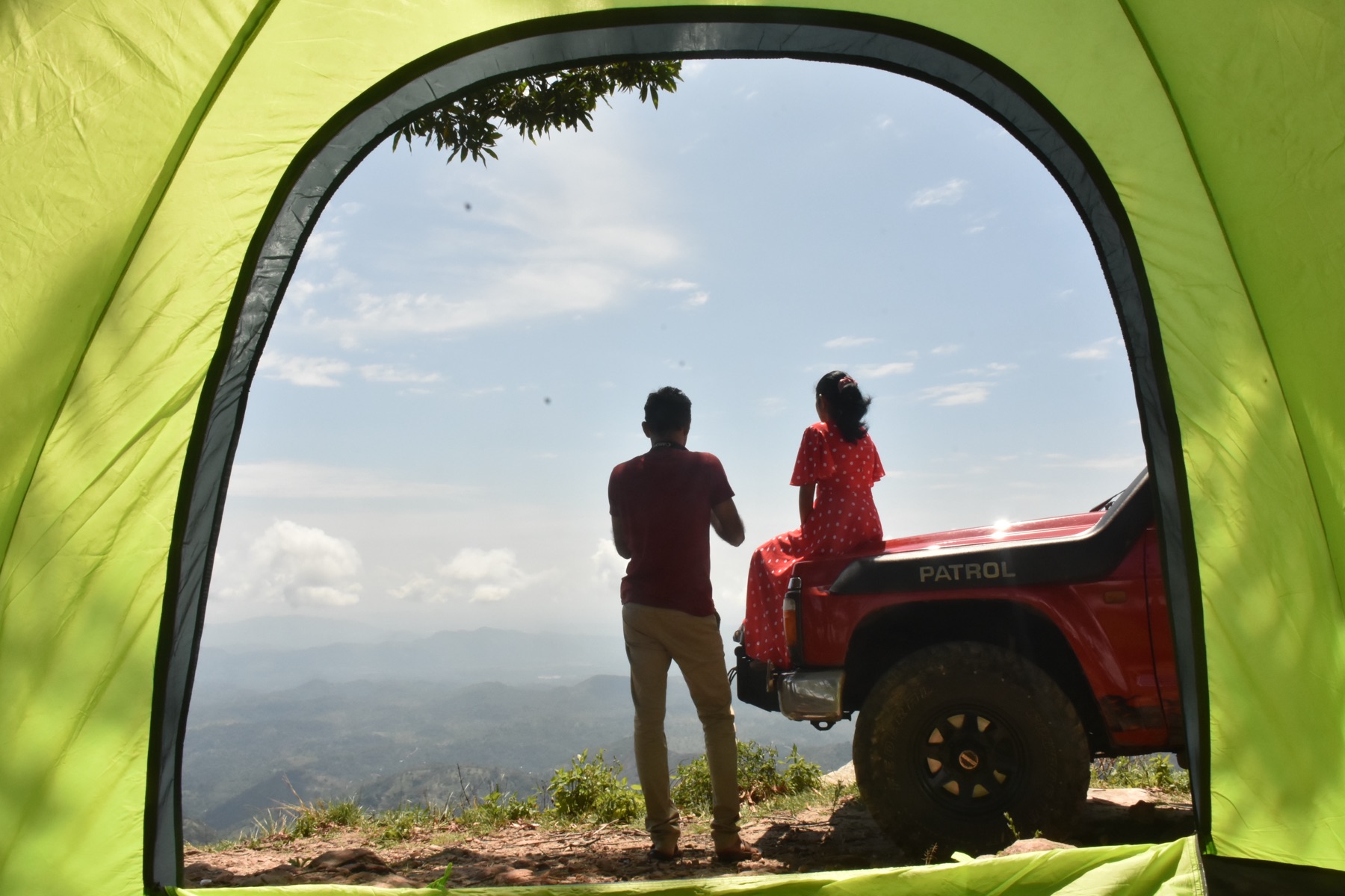
Babara Gala Pathana has a special charm that is difficult to describe. We have not seen another place in Sri Lanka that can truly be compared to it. One of the main reasons for its beauty is the scattered old trees that remain on the open hilltop in a natural and uneven pattern. They give the whole landscape a unique and unforgettable appearance.
The land area of Babara Gala Pathana covers about 10 acres. It is believed that the forest plantation here was started around the 1980s.
There is also a historical story connected to this place. During the Second World War, a military camp is said to have existed on the top of this pathana. Even today, the remains of some buildings can still be seen. It is also said that a telescope had been installed at the camp to observe the coastline and watch whether enemy forces were approaching the country from the sea.
This location is ideal for such observation. On a clear day, when looking directly towards the east, it is possible to see the coastline from Batticaloa to Hambantota. From here, one can also clearly see areas such as Madulsima, the Monaragala mountain range, Gal Oya, Buttala, and Wellawaya. Below the pathana, the paddy fields of Bibilegama and Athpattiya villages can also be seen.
Because this place offers a view of more than 240 degrees, a large part of Sri Lanka can be observed from Babara Gala Pathana. It is also significant because the boundaries of the Passara and Badalkumbura Divisional Secretariat areas, as well as the Monaragala and Badulla District boundaries, run through this Babara Gala Pathana area.
The Uva Province is home to many places with great tourism potential. However, while places like Haputale and Ella receive much attention, Babara Gala Pathana has not yet received the attention it deserves from the authorities.
Although this land belongs to the Forest Conservation Department, it has already become a beautiful location loved by travellers. Therefore, the relevant institutions should work together to properly manage and regulate this site. With careful planning, Babara Gala Pathana could be protected while also being developed as a responsible tourist attraction that can bring foreign exchange to our country.